Climate Chronicles

Temperature Anomaly over period of time from 1950 - 2022

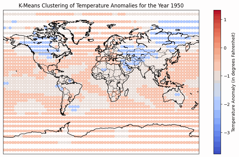
The temperature anomaly heatmap has a refined colormap that uses blues for temperatures below the baseline and reds for temperatures above the baseline. This makes it easier to understand as red signifies heat and blue is associated with cold. The color binning technique is used to categorize temperature anomalies into distinct ranges for better visualization. The darker blue color represents temperature anomalies from -2℃ to -4℃, while lighter blues represent anomalies from -2℃ to 0℃. Similarly, a darker red represents anomalies from 4℃ to 2℃, and lighter reds represent anomalies from 0℃ to 2℃. Notably, the use of color saturation signifies higher anomalies, while color hue indicates the direction of the anomaly (positive or negative). The implementation of a video-style animation addresses the challenge of showcasing temporal variations on a static map. Interactive controls, including a play button, speed adjustment, and a year slider, empower users to customize their viewing experience. The play button facilitates the observation of temperature anomaly trends across multiple years, while the speed adjustment allows for a quick overview or a more detailed analysis. The year slider enables users to navigate to specific years, control the pace of the animation, and track their progress. Additionally, radio buttons offer playback modes such as "Once," "Loop," and "Reflect," allowing users to tailor the viewing experience to their preferences. However, a notable tradeoff of the video-style animation is the absence of hover, zoom, or pan functionality for the map. This limitation restricts users from analyzing specific areas or determining precise temperature anomalies at a given time, emphasizing a focus on overall trends in more general geographic regions.

 
Figure 1. This heat map represents temperature anomalies using color, where the observed average temperature of each year at each location, according to longitude and latitude, is compared to a baseline temperature (the average of 1991 - 2020). The temperature at a particular location is then compared to the baseline and represented as the deviation from that baseline. The use of color allows for quick visual recognition of negative and positive deviation from the baseline and where on the map the deviation occurs. Also, there are tens of years worth of data that need to be encoded, and they cannot all be displayed using a single static map. For that reason, each year is given its own map, that can then be interacted with by the user. Users are able to play an animation that automatically goes from 1950-2022 and use a scroll bar to select a specific year to analyze further. Other user interaction examples include pausing the animation or adjusting the speed of the animation.

K-Means Clustering with Color Luminance Mapping

The choice of k-means clustering is strategic, leveraging its robust capability to aggregate data points with shared characteristics - here, the temperature anomalies. This clustering lays the groundwork for a compelling visualization, where color luminance mapping plays a pivotal role. It brings the data to life by clearly depicting each cluster's average temperature anomaly. Such a visual treatment not only simplifies the recognition of geographical patterns but also improves the distinctions among the clustered regions, streamlining the interpretive process for the observer. By introducing a global temperature anomaly baseline, this enhanced visualization method categorizes regions into clusters based on their relative temperature differences: warmer, similar, or cooler than the global mean. This not only specifies which areas are experiencing warming or cooling trends over time but also highlights unusual fluctuations - regions that unexpectedly deviate from their historical temperature patterns. The use of the color luminance effectively distinguishes these clusters, employing a spectrum where intense red signifies areas significantly hotter than the global baseline and deep blue marks much colder zones. White is reserved for those regions whose temperature anomaly aligns closely with the global average. This visualization technique allows for a more dynamic and insightful exploration of climate data, facilitating the identification of both gradual shifts and abrupt changes in regional temperature anomalies in relation to the global climate benchmark.

 
Description of the image
Fig 2. 1950 Global Climate Deviations Map: Illustrated here are the outcomes of the k-means clustering analysis on the worldwide temperature deviations for 1950. Geographic coordinates are marked by dots, with their coloration signifying the cluster categorization correlated with the temperature variance. The spectrum of color from cool blue to warm red denotes the range of anomalies, blue for temperatures below, and red for temperatures above the long-term average. This clustering highlights geographic patterns in temperature changes, essential for understanding climate variations. A color gradient bar to the right serves as a key to the anomalies, and the continental outlines provide spatial context. The contrasting striped overlay aids in differentiating the areas of temperature anomalies for enhanced visual clarity.

Temperature Anomalies for south & North pole comaprision with global mean

The Fig3. represents temperature anomalies for the South Pole, North Pole, and the global mean, plotted over a timeline from the 1950s to the early 2020s. The marks used in the graph are lines connected by points,to effectively show changes over time. color channels are used to differ the South Pole, North Pole,and the global mean. These colors are chosen for their contrast against the white background, ensuring that each trend is distinct and easily readable. The lines are accompanied by points at each year mark, providing accurate references for the anomalies each year. The use of contrasting colors aids viewers in distinguishing between the data series in cases where the lines might cross or overlap, enhancing the graph’s readability and interpretability.

 
Figure 3. Line graph visulizing Temperature Anomalies over time with global mean at north & south poles